 Skip to content
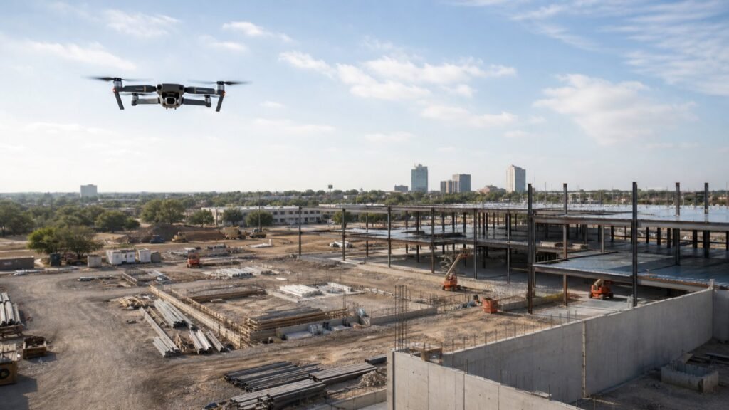
Short answer: drone photography for construction progress in San Antonio is most useful when it creates the same decision-ready view of a project at planned milestones. The goal is not simply to collect impressive aerial footage. It is to give owners, project managers, leasing teams, investors, and marketing staff a consistent way to see site context, major work zones, access, and visible change over time.
That means a good plan starts before the drone launches: agree on the purpose of the update, identify the approved capture positions, choose the people who can authorize access, and define the delivery format. A polished aerial clip can be a valuable marketing asset, but it should not be mistaken for a site inspection, a survey, an engineering record, or proof that work meets a particular standard.
This article focuses on a narrower use case than Nitro’s general San Antonio drone-video hiring guide: recurring construction-progress communication. It does not promise project outcomes, quote fixed prices, or give legal advice. A remote pilot and the site team still need to make the operational decisions for the exact location, date, weather, airspace, people, and work conditions.
When is drone photography worth adding to a construction-progress plan?
Drone photography is worth adding when a ground-level update cannot quickly communicate the project’s overall state. A repeatable aerial view can help a distributed owner group orient itself, let a leasing or development team explain what is changing, give a marketing team current visuals, and reduce the ambiguity that comes from a pile of isolated phone photos.
It is especially helpful when a project has a clear sequence of visible change: site preparation, foundation work, framing or steel, enclosure, exterior progress, paving, landscaping, and final site presentation. The value comes from comparison. One dramatic flyover is useful for a launch announcement; a matched set of views at agreed milestones is more useful for a progress story.
Before adding a drone to the schedule, answer four questions:
- Who needs the update? An owner may need a broad site orientation. A project manager may need a concise visual supplement for a status meeting. A marketing team may need clean, brand-safe shots for a launch, recruiting, or investor presentation.
- What decision should the update support? “Show progress” is too broad. Better answers are “help remote stakeholders understand the current phase,” “create a before-and-after archive,” or “show leasing prospects how the site relates to nearby access points.”
- What needs to stay consistent from visit to visit? Define the same approach angle, height where appropriate, work-zone views, and time-of-day preference. A different route every month makes comparisons less useful.
- What is the deliverable? A raw folder, labeled stills, a two-minute recap, a set of vertical clips, and a project archive are different jobs with different review requirements.
For broader context on how aerial assets fit commercial storytelling, see Nitro’s commercial-drone applications guide. The construction-progress version should stay more disciplined: it is a planned visual record first and a cinematic showcase second.
What should a construction-progress drone shoot document?
The strongest construction-progress shoots document a small, intentional set of views—not every possible shot. Start with a repeatable capture map that ties each image or clip to a communication need.
| View | What it helps viewers understand | What to keep consistent |
|---|---|---|
| Site-context wide shot | Parcel position, adjacent roads, access, and the overall footprint | General direction, framing, and time-of-day range |
| Primary elevation | How the visible façade, structure, or enclosure is changing | Camera position and focal length where practical |
| Work-zone overview | Relationship between the active area and the larger site | Approved safe observation position and clear labeling |
| Approach or circulation view | Entrances, parking, logistics routes, or the finished user journey | Direction of travel and project milestone label |
| Detail-context shot | A visible change that needs surrounding context | A wide companion image; do not use a detail in isolation |
| Marketing clean plate | A less cluttered shot suitable for future web, proposal, or social use | Brand review, privacy review, and a clear usage note |
The table is a planning tool, not a flight prescription. On a live construction site, conditions change. The project team and remote pilot may decide that a planned angle is not appropriate that day because of people, equipment movement, visibility, weather, airspace, or site rules. In that case, the right outcome is a clear note about what changed and why—not a risky attempt to reproduce the shot.
How do you make the photos comparable month after month?
You make them comparable by agreeing on a capture brief that survives staff changes. Store a simple one-page “progress map” with a labeled aerial overview, a small list of approved viewpoints, and a delivery naming convention. Every visit should start with that map, then be adapted by the people responsible for that day’s operations.
An effective naming pattern is simple: Project_Name_YYYY-MM-DD_View-01_Site-Context and Project_Name_YYYY-MM-DD_View-04_West-Elevation. It lets a nontechnical stakeholder open two folders months apart and compare the same frame without guessing. Keep a separate notes field for exceptions: weather, an inaccessible work area, a temporary obstruction, a changed viewpoint, or an executive-requested marketing shot.
Avoid treating the full capture library as a social-media feed. Progress photos work best when the viewer can answer three questions in under a minute: What part of the project am I seeing? What has visibly changed since the last update? What remains unclear or needs a follow-up from the project team? A long folder of unlabeled aerials can look impressive while doing none of those jobs.
Should a construction team order drone stills, video, or both?
Most projects benefit from a small, repeatable still set plus a limited number of short video clips. Stills are easier to compare, place in reports, annotate, and reuse in presentations. Short video adds context when movement matters—such as a site approach, circulation path, or a wide reveal of a major phase change.
| Deliverable | Best use | What to decide before shoot day |
|---|---|---|
| Labeled aerial stills | Status reports, owner updates, executive decks, archive | Required views, aspect ratio, retention location, and naming |
| Short landscape clips | Project recaps, investor updates, website sections | Length, audio/no-audio expectation, branding, and who approves the cut |
| Vertical clips | Controlled social or recruiting use | Crop-safe composition, any visible people or branding, and final platform |
| Monthly recap edit | Stakeholder communication and milestone history | Narrative owner, review window, source footage ownership, and delivery date |
| Marketing image selects | Launch, leasing, proposal, or recruiting collateral | Brand review and whether construction clutter should remain visible |
The broader corporate-video production guide for San Antonio is useful when the construction update will become part of an executive or brand-video strategy. Keep the two scopes distinct: a recurring documentation package needs consistency; a marketing edit needs a message, audience, and approval path.
What should happen before a drone arrives on site?
Before a drone is scheduled, the site contact and production contact should agree on a short preflight coordination checklist. This is not a substitute for the remote pilot’s required flight planning or the contractor’s own safety procedures. It is how the people involved avoid preventable confusion.
- Name one site contact. That person confirms access, expected work activity, site-specific rules, meeting point, and who can pause or redirect the shoot.
- Define the day’s scope. List the repeatable views, any priority phase changes, and any assets required for a marketing deliverable.
- Identify sensitive material. Flag protected plans, security-sensitive areas, client names, vehicle plates, worker privacy concerns, or proprietary equipment that must not appear in a public-facing edit.
- Set a communication method. The production team needs a reliable way to contact the site lead if conditions change. The site lead needs to know the scope is visual documentation—not a direction to alter work for the camera.
- Decide on worker awareness. The contractor should handle any site-specific communication or signage required by its policies. Do not assume a drone operator can replace site-management communications.
- Set the weather and reschedule rule. Pick a decision time and decide who makes the final call. A rushed “we are already here” decision is not a good reason to force a shoot.
For businesses deciding whether to maintain a full in-house program or bring in a specialist, Nitro’s guide to the pros and cons of outsourcing industrial video production offers a useful planning lens. The decisive factor is rarely the drone itself. It is whether the team can consistently coordinate access, approvals, deliverables, and safe execution.
What FAA considerations matter for construction-progress drone work?
Commercial construction-progress footage is commonly a Part 107 use case, but the remote pilot—not this article—must determine whether an operation can proceed and what requirements apply. The FAA’s commercial-operator guidance explains the Part 107 pathway for small drones used for work or business, including remote-pilot certification and registration requirements.
Three operating concepts are especially important to a project team because they affect schedule and shot planning:
- Exact location matters. A San Antonio address is not a blanket permission to fly. The remote pilot must evaluate the actual airspace, temporary restrictions, notices, weather, and operation. The FAA explains that LAANC can provide airspace authorizations for certain controlled-airspace operations, but it provides airspace authorization only; pilots still have to check other applicable conditions and restrictions.
- A 400-foot number is not a creative brief. The current federal rule in 14 CFR § 107.51 generally limits small UAS altitude to 400 feet above ground level, with a specific structure-related provision. That does not mean a particular construction shot is automatically appropriate at that height. The remote pilot must plan the operation based on the actual site and applicable rules.
- The pilot needs visual awareness. Under 14 CFR § 107.31, the remote pilot, person manipulating controls, or a visual observer must be able to see the aircraft throughout the flight for the purposes listed in the regulation. A construction site with equipment, structures, dust, or changing work zones may affect how the pilot plans the day.
Remote ID is another planning checkpoint. The FAA describes Remote ID as the ability of a drone in flight to provide identification and location information via broadcast signal, and its guidance explains which registered drones must comply. Ask the vendor how they handle FAA compliance, but do not ask them to promise a flight before reviewing the actual operation.
For a nontechnical buyer, the practical takeaway is straightforward: schedule the shoot early enough that a professional can evaluate the operation. Do not make a public launch, lender update, or executive meeting depend on a same-day aerial shot without a backup plan. Nitro’s article on why the right video-drone operator matters more than the drone explains the broader hiring logic.
How should you scope a construction-progress drone vendor?
Scope the vendor around the result the project needs, not around a vague promise of “drone coverage.” Ask for a written brief that separates capture, editing, approvals, and archive responsibilities.
Use these questions during selection:
- Can you work from a repeatable capture map and label each required view?
- Who is the remote pilot in command, and who owns the airspace and flight-planning decision?
- What access, safety orientation, escort, and site-contact requirements do you need from us?
- Which deliverables are included: selected stills, raw files, clips, a recap edit, vertical crops, or a project archive?
- How will you identify exceptions when a planned view cannot be captured safely or compliantly?
- How are files named, delivered, backed up, and retained?
- What review process applies before images are used publicly?
- Who confirms that no private, security-sensitive, or unapproved material appears in a marketing edit?
If the project also needs broader commercial storytelling, use the San Antonio video-production company selection guide to compare the team’s ability to plan, communicate, and deliver—not just its equipment list. A construction-progress provider should be comfortable saying that a particular shot will wait or change when conditions require it.
How do you turn progress footage into a usable update?
Turn it into a usable update by pairing visuals with a short, human-written status note. The drone team can organize and edit media; the project team should provide the context that explains what the viewer is seeing. Avoid captions that make technical claims the production team cannot substantiate.
A good monthly update might include:
- a labeled site-context image;
- three to five matched progress images;
- one short, captioned landscape clip;
- a dated note from the project team explaining the current phase in plain language;
- a short list of any visual caveats, such as access limitations or weather;
- a clear statement about whether the package is internal-only or approved for marketing use.
This format creates a useful bridge between job-site communication and future brand assets. A future case study, tenant announcement, recruiting piece, or proposal can draw from a well-organized archive without pretending that a documentary photo set was created as a campaign. When the time comes to turn an archive into a broader local campaign, Nitro’s local video-production guide can help frame the audience and distribution plan.
Can construction-progress drone photography replace inspection, surveying, or site visits?
No. It is visual communication, not an inspection, survey, engineering assessment, legal record, or substitute for the project team’s own processes. Aerial imagery can help someone ask a better question, but it does not by itself establish measurements, workmanship, safety compliance, property boundaries, schedule performance, or regulatory compliance.
If a stakeholder needs a formal inspection, survey, measurement, or safety determination, use the appropriately qualified professionals and the project’s established procedures. The editorial and production team should avoid labels such as “inspection complete,” “site is safe,” “measured,” or “compliant” unless the responsible qualified party has approved that language separately.
How often should a project schedule drone progress photography?
Schedule it around meaningful milestones rather than an arbitrary weekly promise. Some developments will benefit from monthly matched views; a fast-moving phase may justify more frequent updates; a smaller project may only need a start, midpoint, and closeout set. The schedule should be easy enough for the site team to coordinate and useful enough for stakeholders to notice a real change.
Use a standing plan, then add special captures for major moments such as groundbreaking, steel completion, enclosure, opening, or a stakeholder announcement. The right cadence is the smallest one that gives decision-makers a coherent story.
Bottom line: build a repeatable visual record, not a one-off flyover
Drone photography for construction progress in San Antonio works best when the project team agrees on a repeatable plan, a clear purpose, and a responsible approval path. The most useful package is usually a labeled still set, a limited number of purposeful clips, and a written project update that explains the visible phase change.
Start with the capture map and stakeholder need. Then let the remote pilot and site team make the day-of operational decisions. That approach produces a more credible progress record, gives marketing teams better source material, and avoids the common trap of treating dramatic aerial footage as if it were documentation, inspection, or proof of a result it cannot establish.


